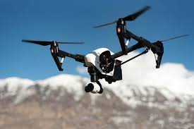
As enterprises pursue more dynamic, data-driven operations, drone analytics platforms are becoming integral to unlocking geospatial insights at scale. These solutions convert raw UAV-captured imagery and sensor data into actionable intelligence—powering informed decision-making across industries where precision, safety, and operational efficiency are paramount.
Core Capabilities of Enterprise-Grade Drone Analytics Software
- Advanced Data Processing & Visualization
Converts aerial inputs into high-fidelity 2D orthomosaics and 3D digital terrain models, enabling macro- and micro-level spatial analysis with real-time updates. - Precision Measurement & Geospatial Analysis
Delivers high-accuracy calculations for distance, area, and volumetrics—critical for stockpile assessments, excavation planning, and topographical modeling. - Ecosystem Integration
Seamlessly connects with enterprise systems (e.g., GIS platforms, ERP, BIM software), ensuring analytical continuity across digital workflows and operational dashboards.
Strategic Industry Applications
- Construction & Mining: Optimize site operations with real-time progress tracking, resource planning, and proactive risk management—driving cost and schedule adherence.
- Agriculture & Land Management: Leverage multispectral analysis to monitor crop health, forecast yields, and inform sustainable land utilization strategies.
- Energy & Utilities: Conduct autonomous asset inspections of transmission lines, wind turbines, and pipelines, minimizing downtime and enhancing regulatory compliance.
Leading Platforms in Enterprise Drone Analytics
- DroneDeploy
A comprehensive cloud-based platform that supports automated mission planning, real-time data stitching, and collaborative reporting. Particularly effective for construction, agriculture, and asset inspection use cases. - Esri ArcGIS
The industry benchmark for geospatial intelligence, ArcGIS supports drone data ingestion within broader spatial analytics workflows. Its integration capabilities make it a cornerstone for enterprises standardizing on location-based decision support. - PIX4Dmapper
A high-accuracy photogrammetry solution used for generating georeferenced spatial models. Known for its precise modeling capabilities, it’s widely adopted in surveying, engineering, and environmental monitoring.
Enterprise Considerations for Platform Selection
- Scalability: Assess the platform’s ability to support multi-site, multi-region deployments.
- Security & Compliance: Ensure robust data governance, encryption, and adherence to industry-specific regulatory standards.
- Integration Architecture: Prioritize platforms offering APIs and native integrations with existing enterprise technology stacks.
- Total Cost of Ownership (TCO): Balance licensing costs with long-term ROI derived from efficiency gains and risk mitigation.
Executive Takeaway
Drone analytics platforms represent a strategic enabler for digital transformation in asset-intensive sectors. By embedding aerial intelligence into enterprise workflows, organizations can enhance situational awareness, reduce operational risk, and accelerate project execution. Selecting the right platform requires a clear alignment between technological capabilities and the organization’s long-term digital maturity roadmap.

